| |
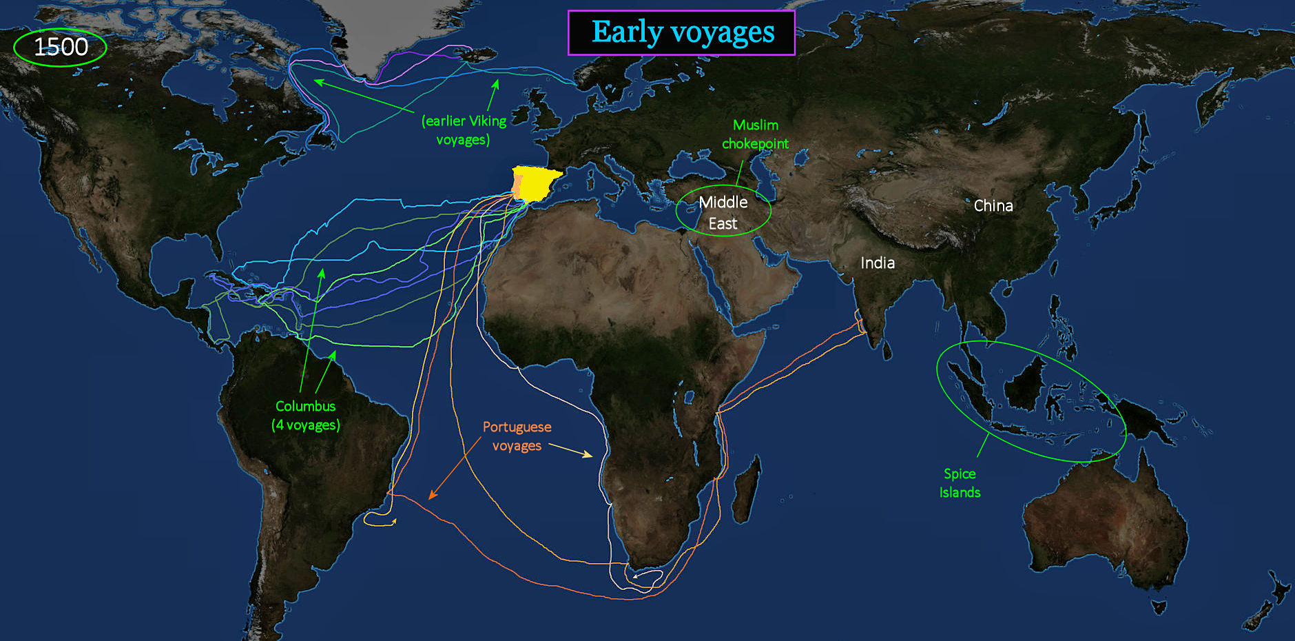
Crossing Oceans The Portuguese (in ORANGE) are the first to sail all the way around Africa, bypassing Muslim control of the Middle East, to establish a new route to the Spice Islands. Columbus, sailing for Spain, tries to reach India by sailing in the opposite direction, not knowing that America is blocking his path. Columbus makes four voyages (BLUE and GREEN), but never actually sets foot in the country we now call America. He gets all the credit, but isn't the first to attempt sailing west. The Vikings (at top) succeed in crossing the North Atlantic 500 years earlier. |
| |||||||||
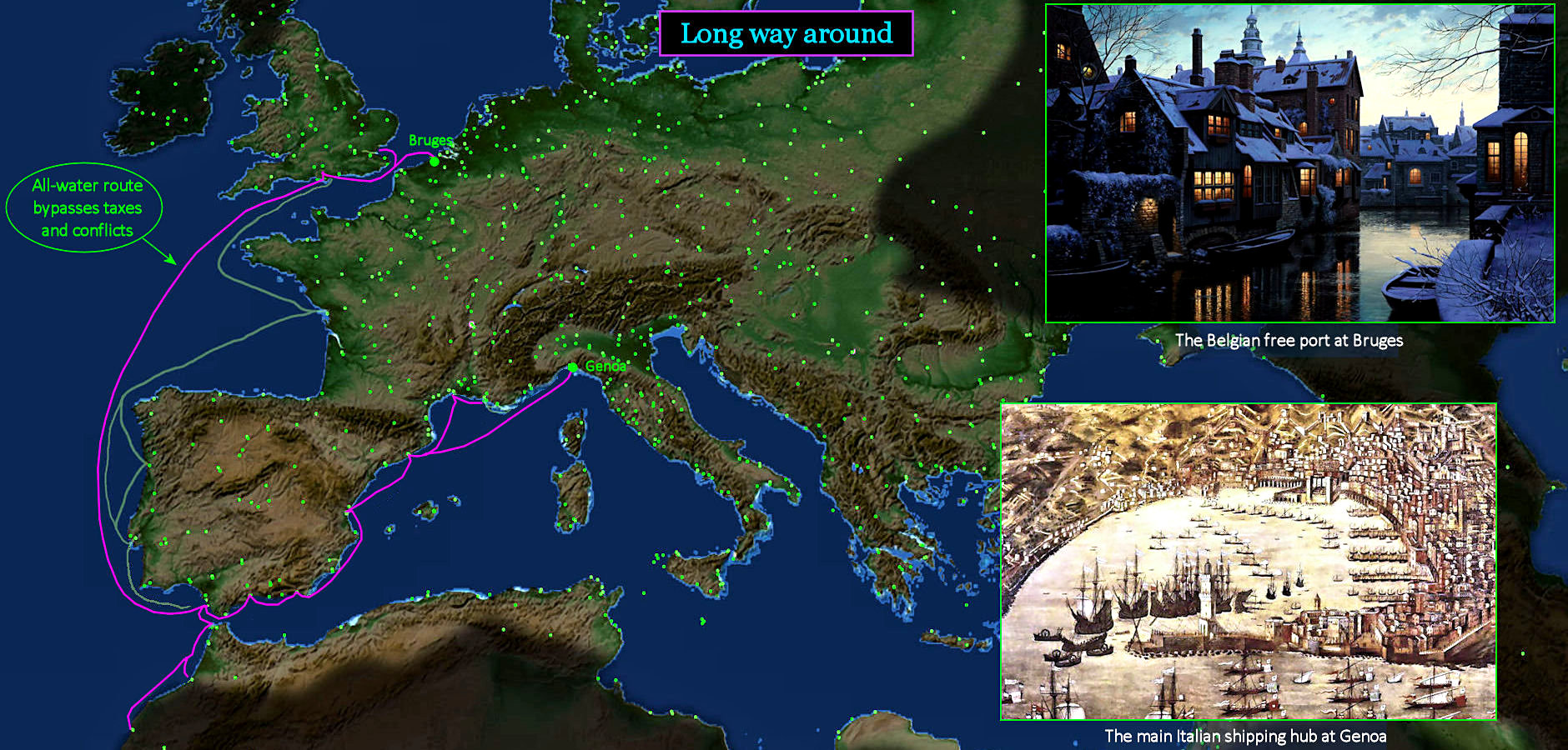
Sailing Around Obstacles European shippers already have a history of avoiding business obstacles by sailing around them. When taxes, regulations and war continue to interfere with the transport of goods north from their ports, the Italians simply sail all the way around Spain and France to the free-market port of Bruges, in Belgium. The most important hub of Italian shipping is Genoa, with its fine harbor (lower right) and strategic location near the heart of Europe. Bruges (top right) is located just beyond the effective control of meddling kings, and manages to remain free of control. It retains a strong medieval flavor to this day. | |||||||||
| |||||||||
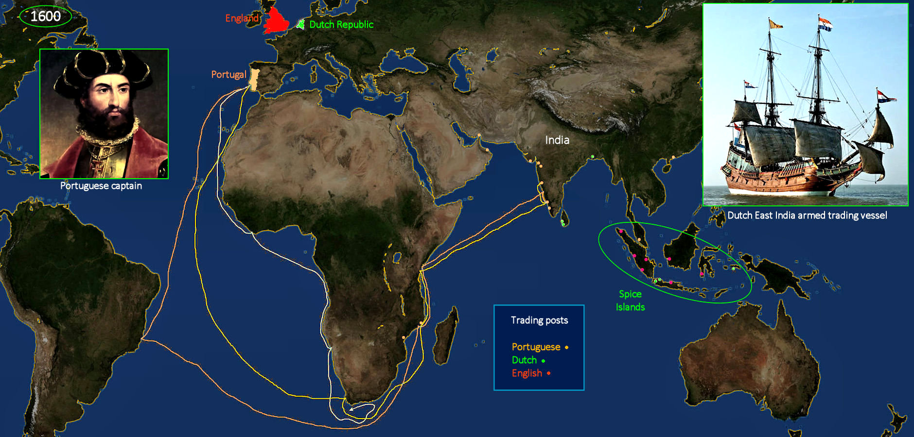
Sailing Around Africa The Portuguese are the first to reach the west coast of India, which is the center of the highly profitable pepper trade. They establish bases in India (ORANGE dots), but are unable to hold onto bases further east in the Spice Islands. Enterprising Dutch merchants in Amsterdam manage to get copies of the Portuguese charts, and muscle their way into the Spice Island trade (GREEN dots). To develop the market, the Dutch create the world's first public stock offering, raising a vast sum of money to launch the hugely profitable Dutch East India Company. Today, this would be called an IPO. The Dutch are soon forced to share this market with a similar British East India Company (RED dots), launched by England at almost the same time. | |||||||||
| |||||||||
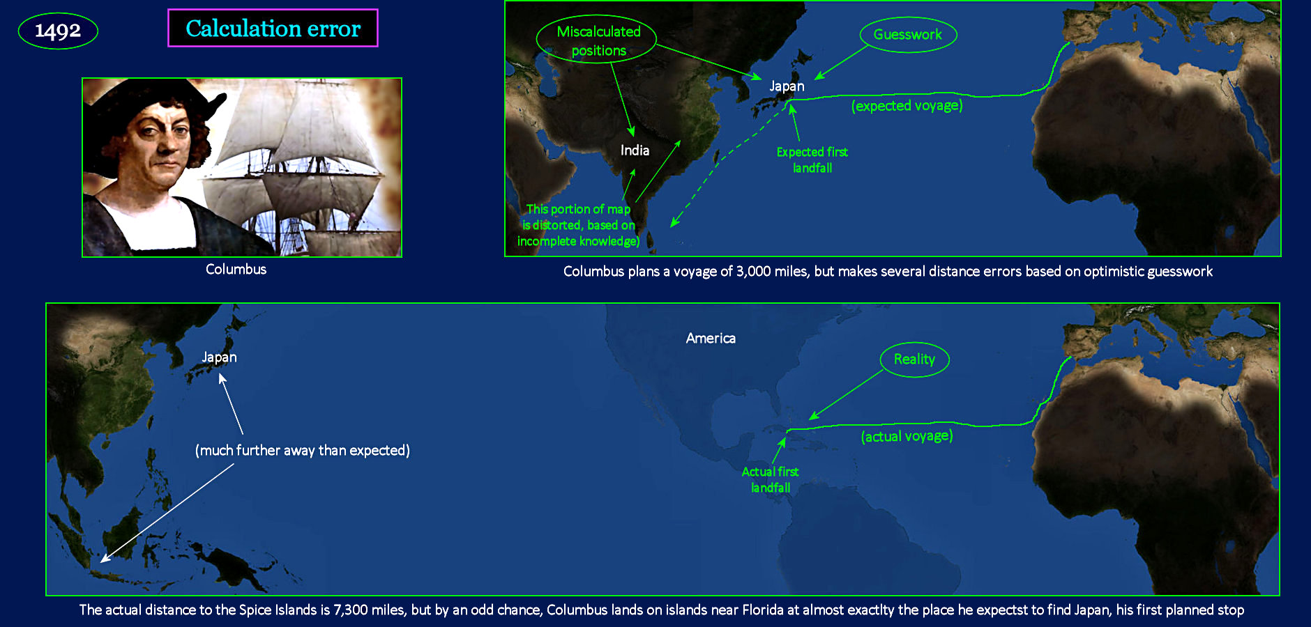
Longer than Expected When Columbus calculates the expected distance for his first voyage, he has to make a couple of guesses. First, he has to figure how big the world actually is. The bigger it is, the longer it will take to sail around to the other side. Then he has to figure the longitude of Japan, his first intended landfall. Perhaps as a victim of wishful thinking, he chooses numbers that produce distances much shorter than actual values. When he tries to get the Portuguese to sponsor the voyage, they turn him down, believing his distance estimates wildly optimistic. Nonetheless, Columbus makes landfall on his first voyage almost precisely where he expected (top chart). But is isn't Japan (lower chart). Instead, it's a cluster of islands in the shallow seas below Florida. | |||||||||
| |||||||||
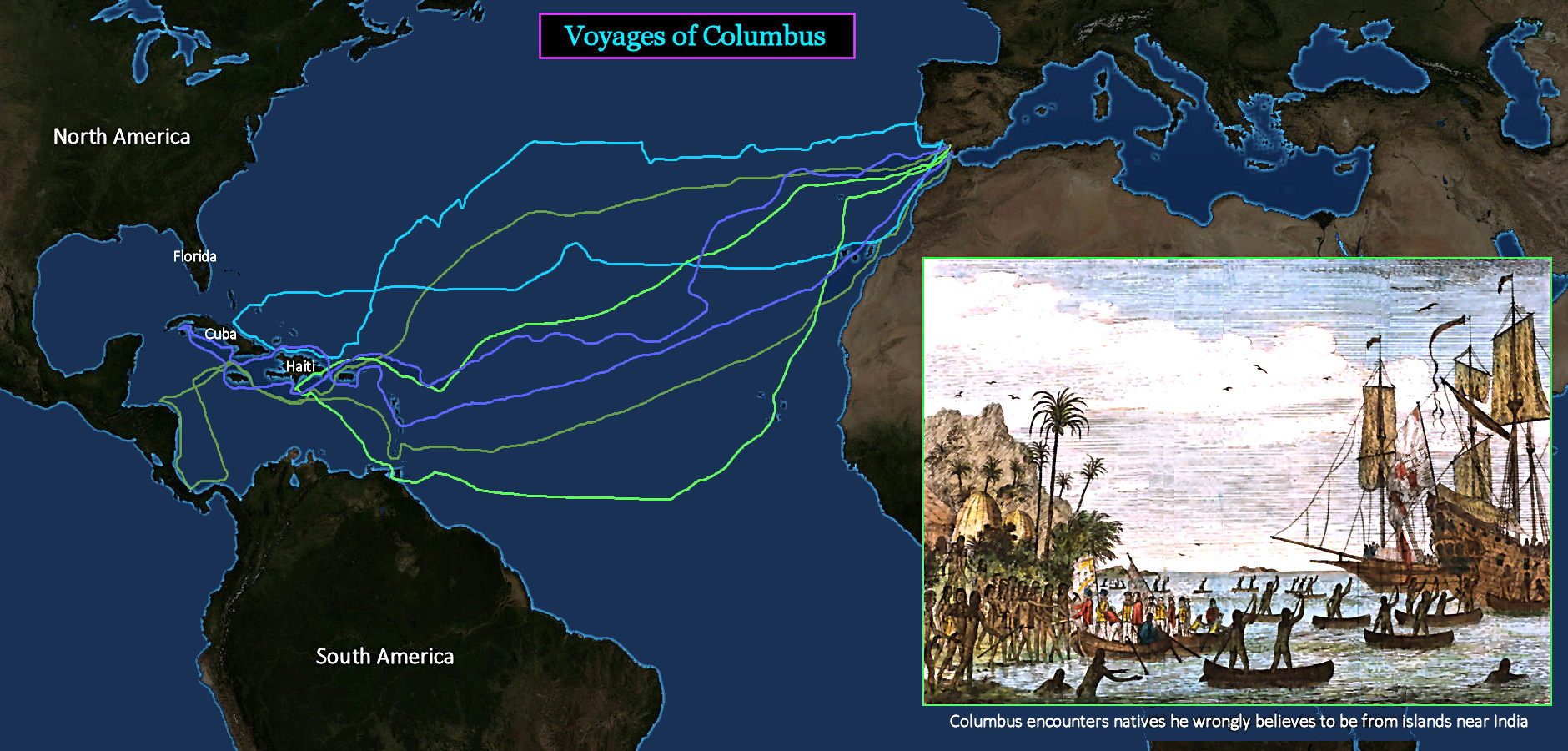
Searching for India The lines above show the routes of the four voyages of Columbus. Note that he never actually reaches the shore of Florida, or any other part of today's America. He is resolutely focused on exploring further South, knowing that India lies well south of Japan, his first planned stop. The native peoples he encounters do not look Japanese, so he assumes the islands must be near India. To the end of his days, Columbus continues to believe that he has actually made it to India, though it never pays off as he imagines. Regardless, most people today still refer to Native Americans as Indians. | |||||||||
| |||||||||
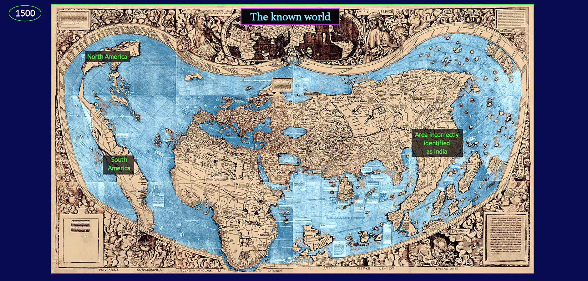
Incomplete World This is the known world shortly after Columbus returns from America, and the Portuguese return from India. North and South America show up only as compacted coastal areas. No one knows what lies further west, and there is no way to know how much water actually separates America from China. The Pacific Ocean is much, much larger than shown here. No one knows what the rest of America actually looks like, because no European has yet set foot on the American mainland. Europe and Africa are shown reasonably accurately, based on Portuguese exploration, but everything beyond India is wildly distorted. India itself is shown as a giant land mass approximately where China is actually located. | |||||||||