| |
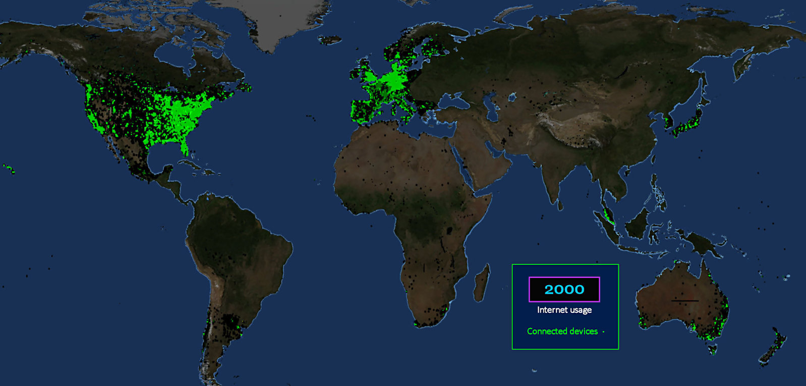
Modest Start This map is a picture of the internet in its infancy. It's almost adorable, at age five. (Unbelievably, there was no internet before 1995.) The digital world we inhabit today is barely 30 years old. |
| |||||||||
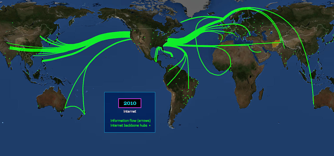
Growing Fast This is the same world, just five years later. The GREEN dots are backbone hubs, which are now located in places like New Zealand, and even Africa. Fiber-optic cables beneath the ocean provide the connection. Where electrons flow, information travels. | |||||||||
| |||||||||
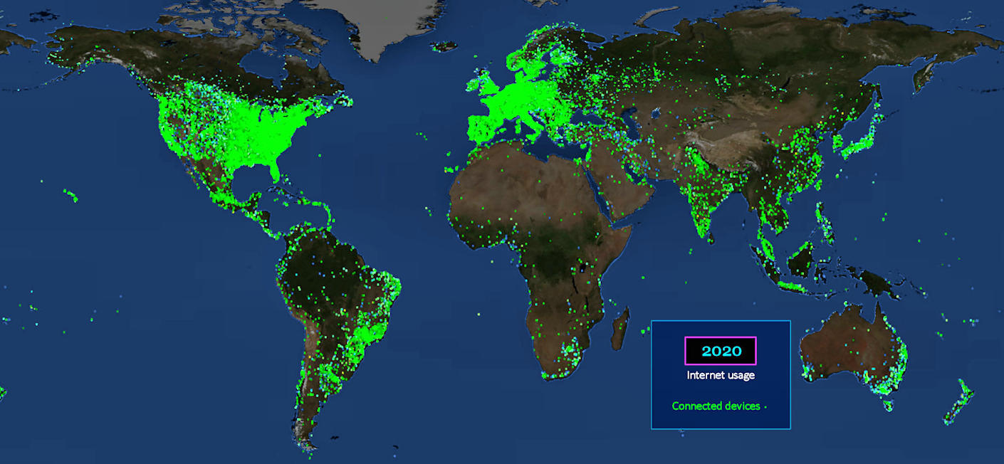
Everywhere, All at Once Fast-forward 10 years, and the entire planet is glowing in the soft light of cell phone screens, tablets, kiosks and digital billboards. You want to connect with Mongolia? Wait a micro-second. | |||||||||
| |||||||||
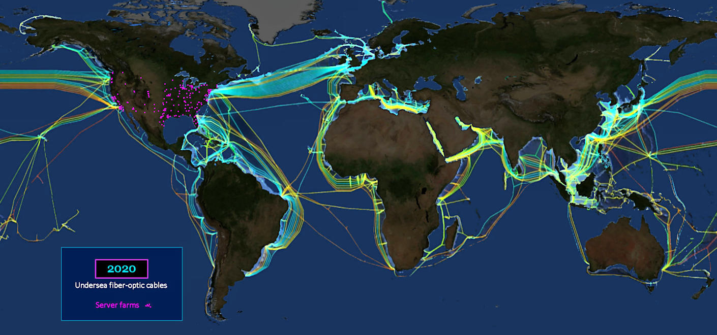
Internet Backbone The internet is enabled by a massive network of undersea fiber-optic cables. Server farms, which store all our data, are similarly spreading everywhere, as the RED dots above show. | |||||||||
| |||||||||
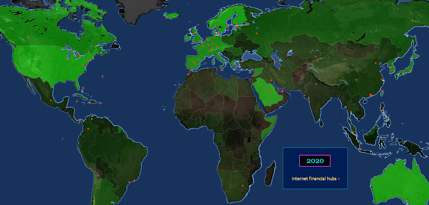
FinTech The RED dots indicate the location of hubs for internet financial transactions. These have been proliferating in recent years, as digital commerce continues to grow. Note the cluster in the Middle East. | |||||||||
| |||||||||
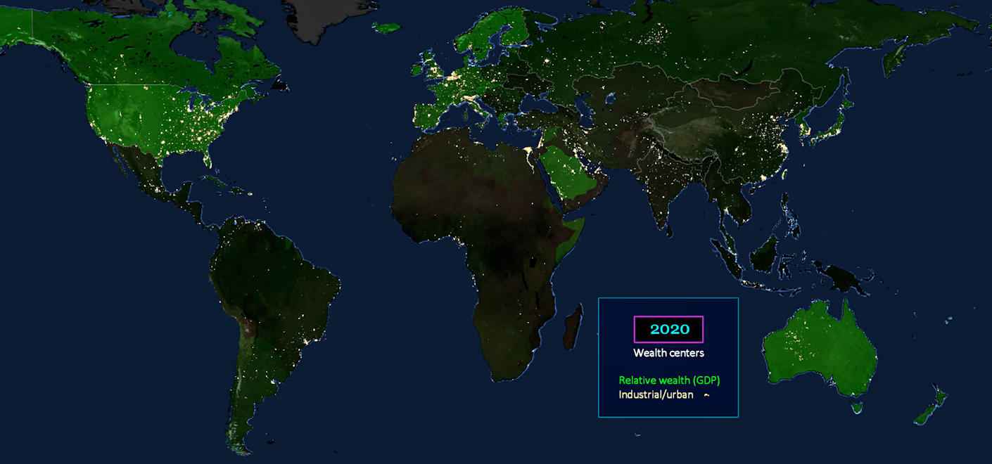
View from Above The YELLOW speckles on this map are lights viewable from space, revealed by actual night-time satellite photos. The GREEN highlights have been superimposed to indicate per-capita wealth. Note that some darker areas, with the least wealth, are still lit up with economic activity, like China and India. | |||||||||