| |
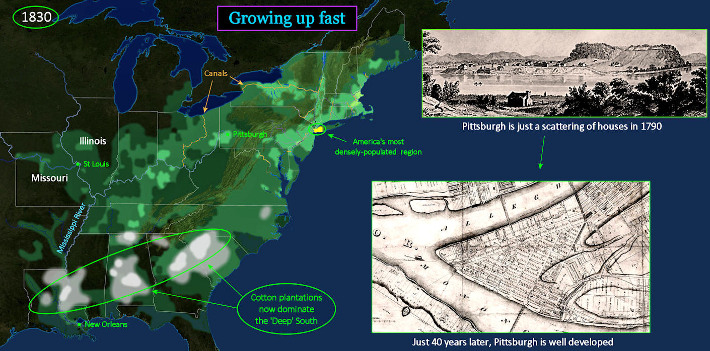
Missouri is the new 'West' The growth in Pittsburgh, which has tripled in size in just 20 years, is typical of what is occurring all over the new 'West,' Steam power has enabled this growth, especially now that canal locks bypass the only rapids on the Ohio River. This allows steamboats to travel from Pittsburgh all the way down to New Orleans. Meanwhile, cotton is now the dominant Southern product. |
| |||||||||
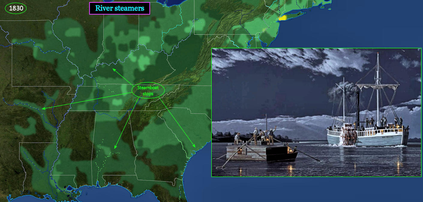
Steamboat Stops are Everywhere The little flatboat shown above is symbolic of a slower, soon-to-be forgotten era. It acts as a tranquil floating home for the six or eight weeks it will take to float downriver to the booming port of New Orleans. But it will be a one-way journey, as rafts cannot travel back upstream. The other vessel is big and modern, the first arrival of a new industrial era that is just about to overtake the nation. It can go upriver and downriver with equal ease, making it suitable for commerce on a scale never before imagined. | |||||||||
| |||||||||
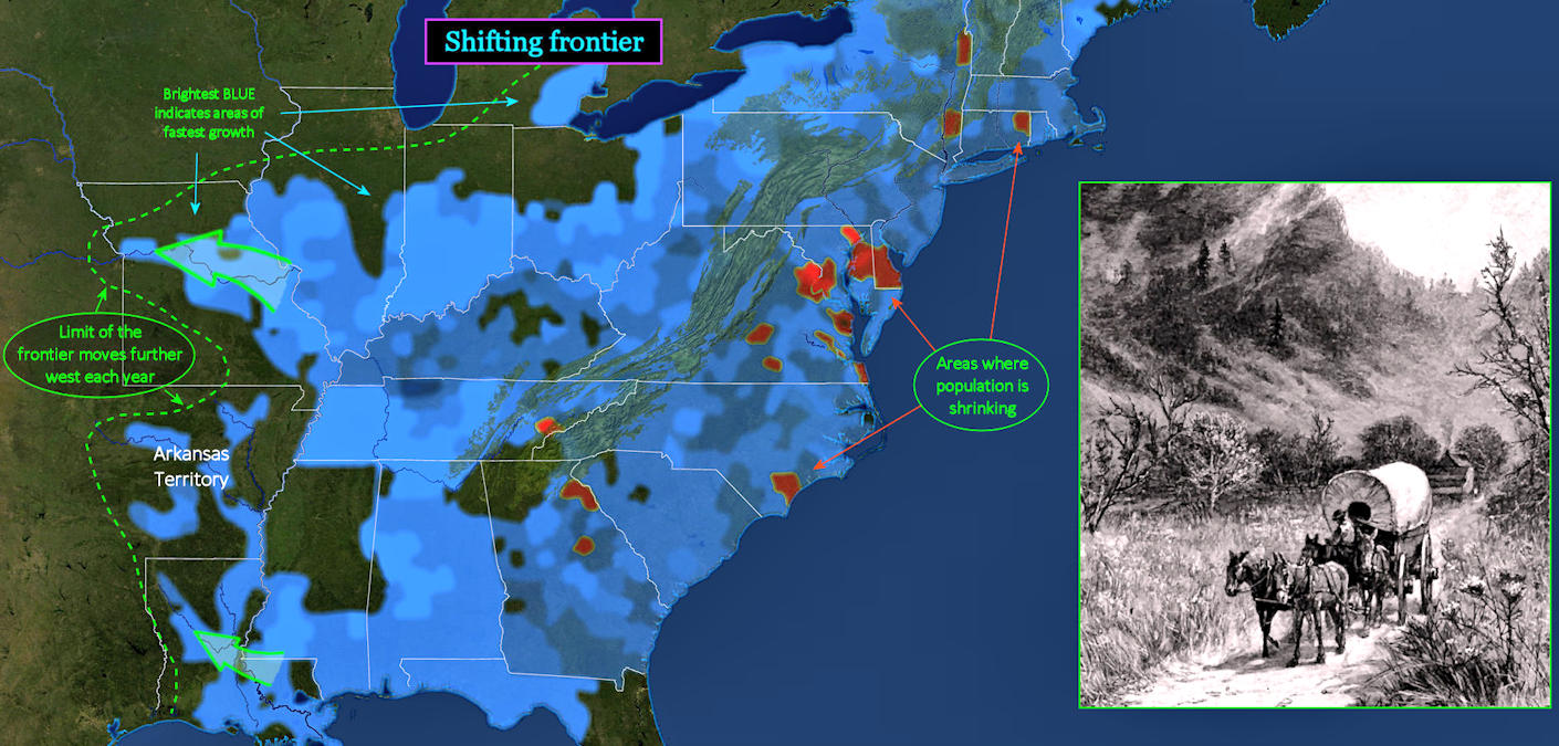
Western Edge This view shows the fastest-growing regions in 1830. The brighter BLUE areas are growing fastest, while RED areas are shrinking. As settlers move west, this bright edge of growth keeps moving with them, always shifting further west. The word 'frontier' is used to describe the rough boundary between settled land and 'Indian Country.' The term 'Indian troubles' refers to local resistance by the remaining Indians, as they are forced into drier and more difficult country, with ever-dwindling food resources. | |||||||||