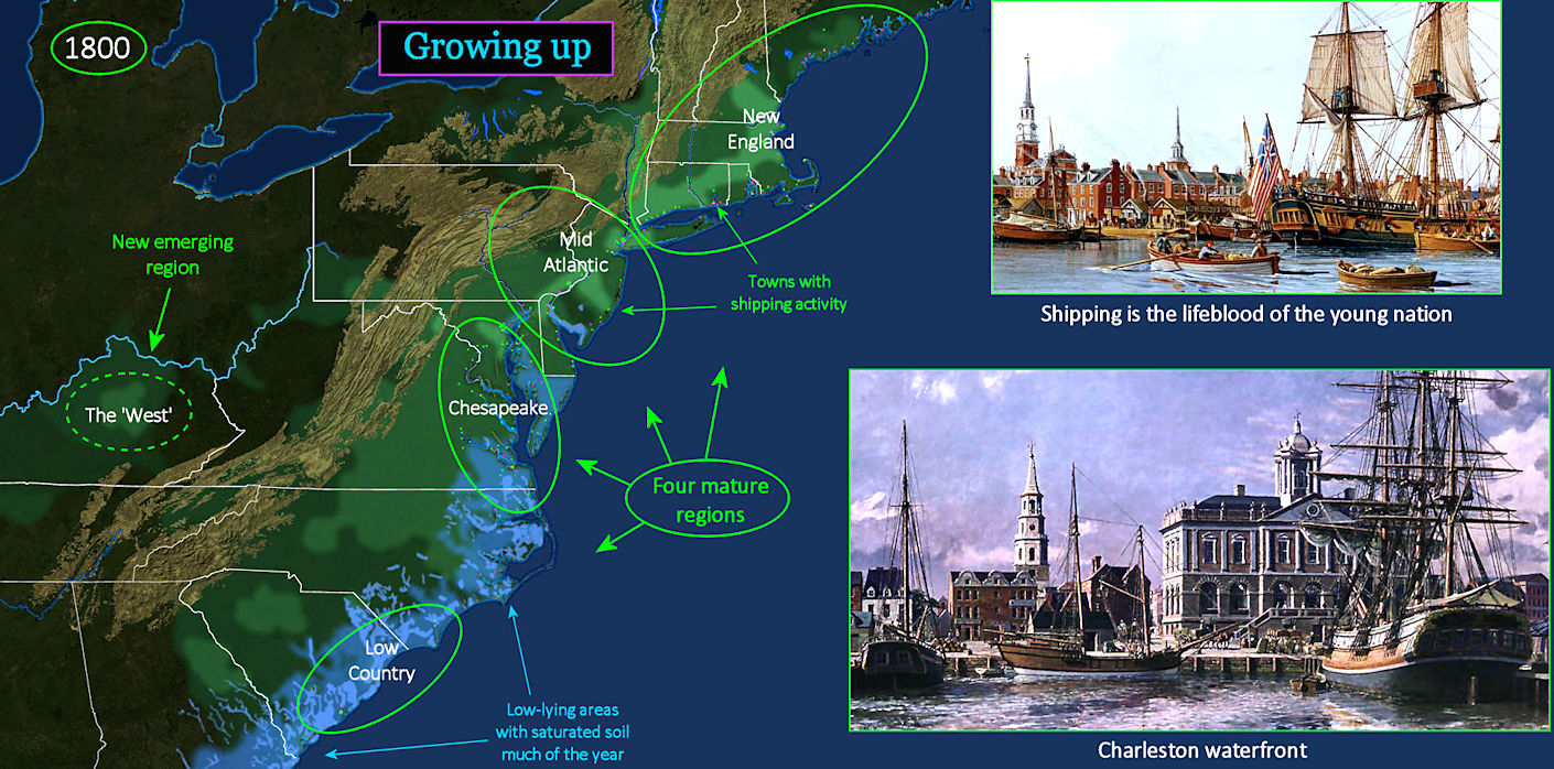
Standing UnitedBut America is not really united. There are still four separate regions, with separate histories and separate economies. The oldest are New England and the Chesapeake Bay tobacco region. In-between are the 'Mid-Atlantic' states of New York, New Jersey and Pennsylvania. This means mainly New York City and Philadelphia. But New York state also extends up the Hudson River, while Pennsylvania stretches far inland. South of Chesapeake Bay is the 'Lowcountry,' a broad coastal lowland with large expanses of marshy wetlands. This is rice country, a land considered unhealthy by plantation owners during the malarial heat of summer. |
| ||||||||||||||||
| |||||||||
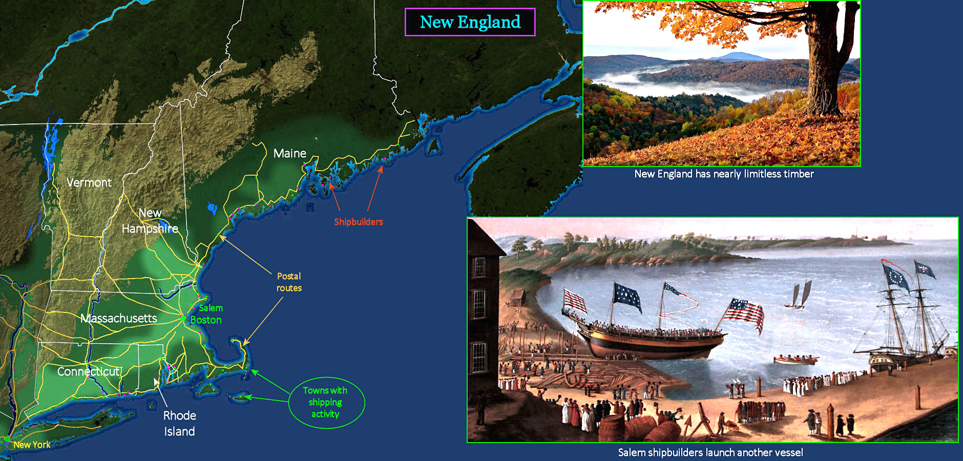
Northern Shipping The heaviest concentration of shipping activity is concentrated around Boston and New York, but smaller towns up and down the coast also have shipping docks to handle the bustling coastal trade (GREEN dots). Many also have shipbuilders located nearby (RED dots). One of the busiest small ports is Salem, which has been prospering in Boston's shadow for years. Its harbor is smaller, but the adventurous spirit runs high. The painting (lower right) is the launching of a Salem fishing schooner, which is typical of activities all over the northern colonies. New England has the greatest density of towns, by far, and the most fully-developed network of mail routes. BROWN lines are mail-carrying routes, some of which also offer stagecoach service. | |||||||||
| |||||||||
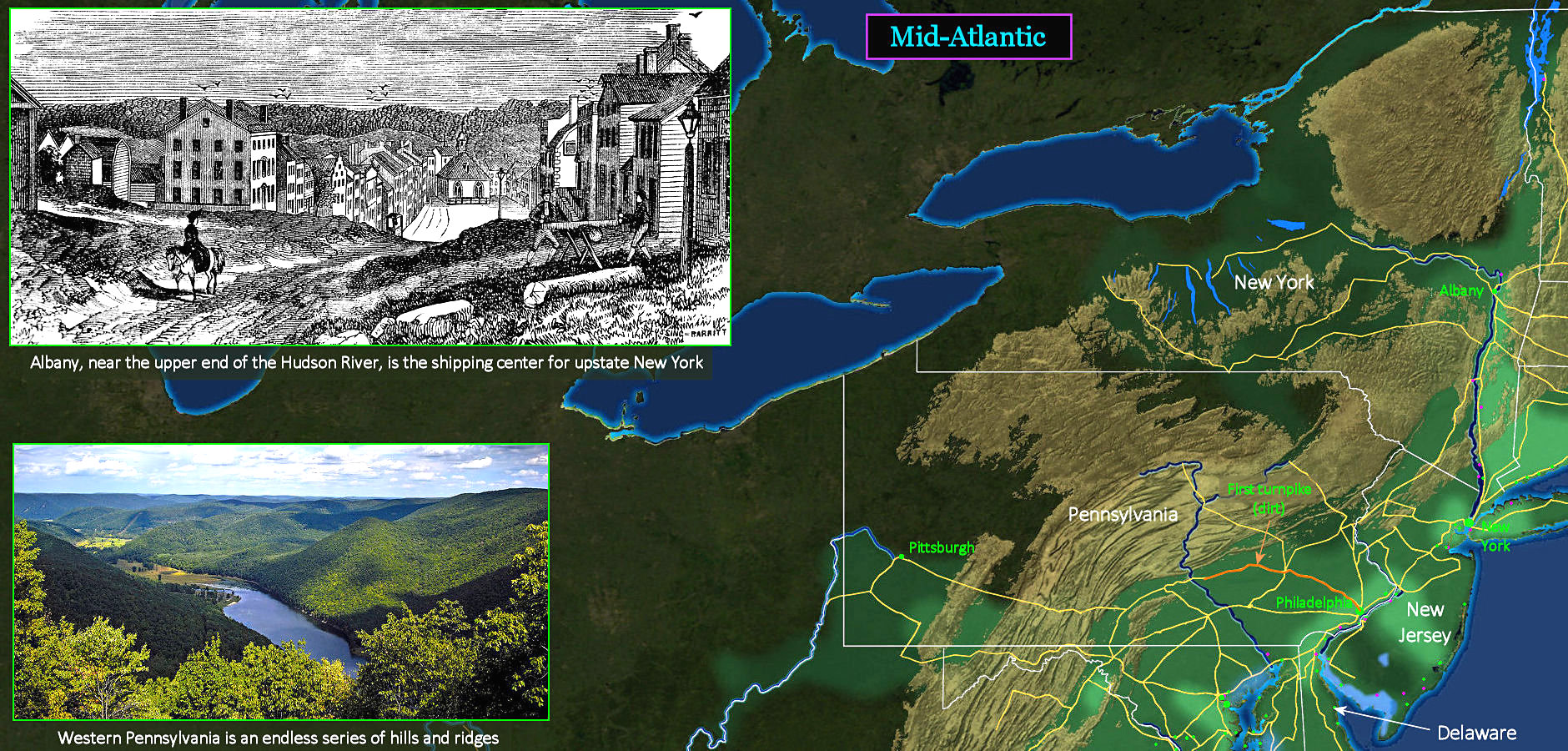
Mid-Atlantic Region The region lying between New England and Chesapeake Bay, called the Mid-Atlantic, has long been dominated by the big deep-water ports of New York and Philadelphia. But the future lies in the largely unsettled land west of the mountains. New York State has a network of postal roads which connect the new state capital at Albany, up the Hudson River, with more western regions. Pennsylvania is beginning to spend heavily on extending roads westward, with new towns surrounding Pittsburgh, the most westerly city in America. This will soon become America's first industrial city, founded on iron and coal. | |||||||||
| |||||||||
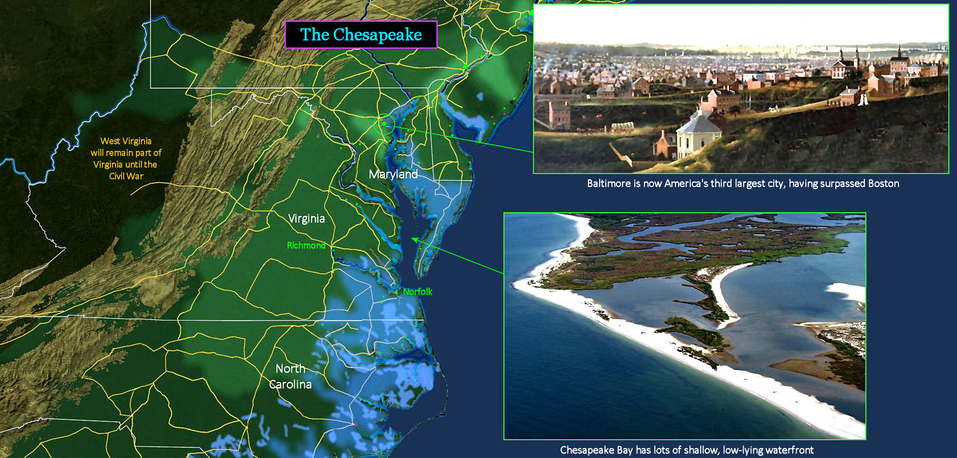
Tobacco Country The area surrounding Chesapeake Bay, often shortened to simply 'The Chesapeake,' is still almost purely a land of tobacco plantations. Barrels and casks of tobacco are shipped directly from wharves and loading docks maintained by plantations along the many tidal inlets. The GREEN circles are larger shipping sites, while the RED circles are shipbuilders. There are almost no real towns anywhere in Virginia, although mail routes maintain communications. The view at top is Baltimore, which has abruptly ballooned into a major port city. The region also supports a growing oyster fleet, which works the shallow waters of Chesapeake Bay. Small Scots-Irish settlements at the foot of the mountains remain largely isolated from the broad coastal zone. | |||||||||
| |||||||||
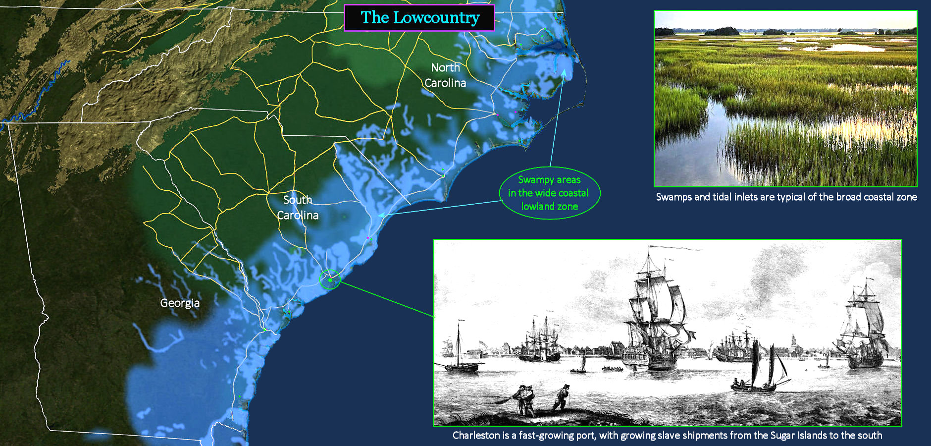
Rice Country The southern coastline is called the Lowcountry because it includes a wide stretch of very low-lying land, extending from Virginia all the way down into Florida. This zone is so close to sea level that the soil remains saturated with water much of the year. Shoreline areas in BRIGHTER BLUE are wetlands that seldom dry out. This actually makes the land well-suited to the cultivation of rice, which is grown in standing water. But the persistent moisture also makes the region a prefect breeding ground for malaria-carrying mosquitos. During the 'sickly season,' many plantation owners move inland, leaving overseers to manage the slaves. | |||||||||
| |||||||||
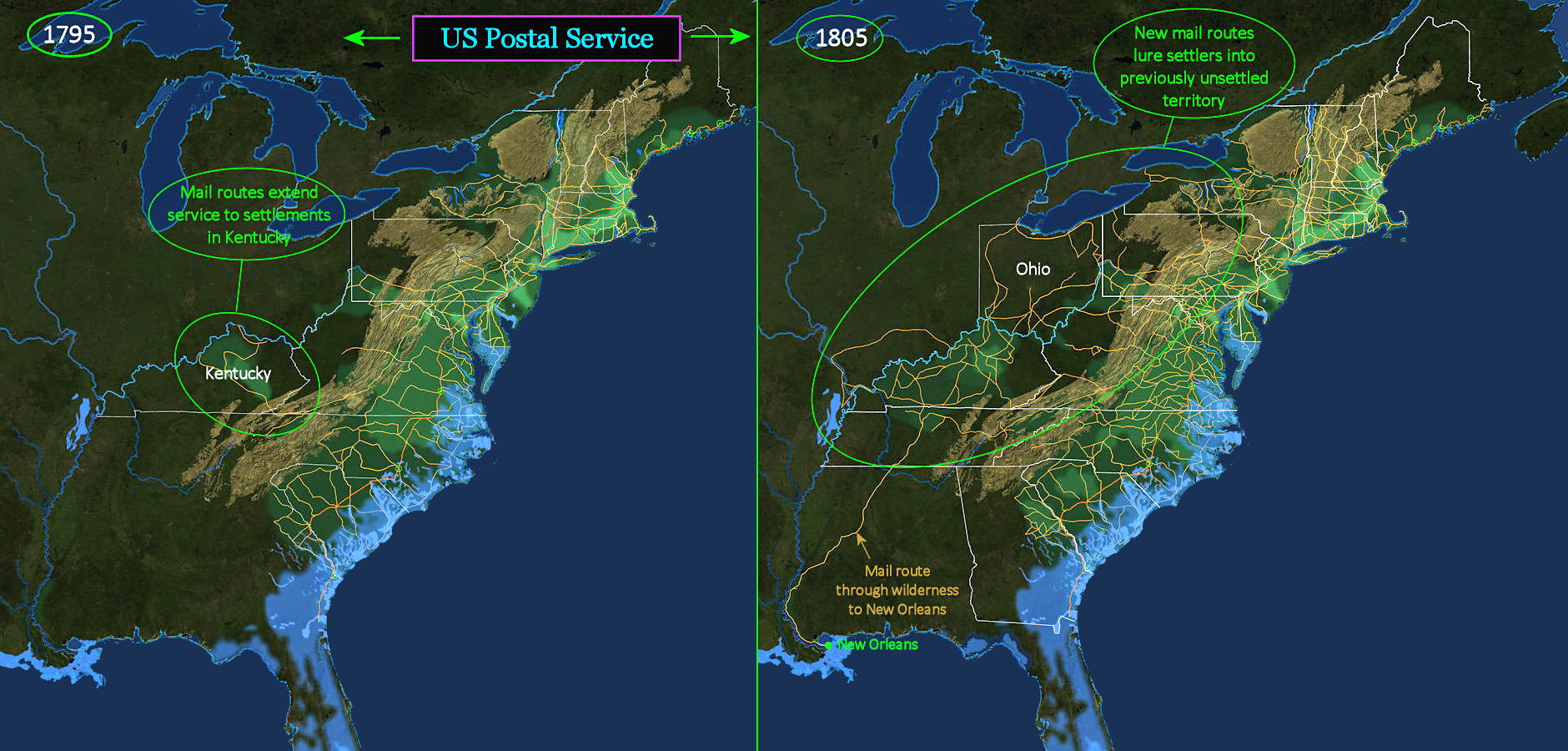
First Federal Agency The Second Continental Congress established the Post Office when America was still ruled by Britain, operating on routes that were previously maintained by the British. Nearly 20 years later, Congress establishes a permanent Post Office Department, and within four years there are new mail routes reaching into existing settlements in the brand-new state of Kentucky (left). The Postal Service then takes on the much broader role of promoting settlement in the entire semi-virgin wilderness west of the mountains. Within ten years, new mail routes crisscross barely-settled western territory, including the new state of Ohio (right). | |||||||||