| |
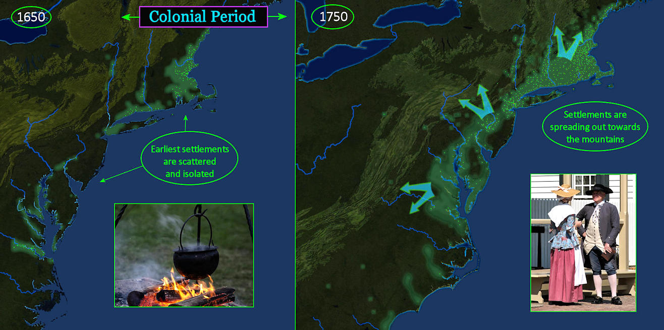
Gradual Growth The map at left shows colonial America after the first wave of settlement, in 1650. Patchy coastal settlements are isolated, and daily life is little more than survival. The map at right is the same view 100 years later, when colonists are beginning to show some style. Towns are thickly scattered in the North, while settlements have pushed towards the mountains everywhere. |
| |||||||||
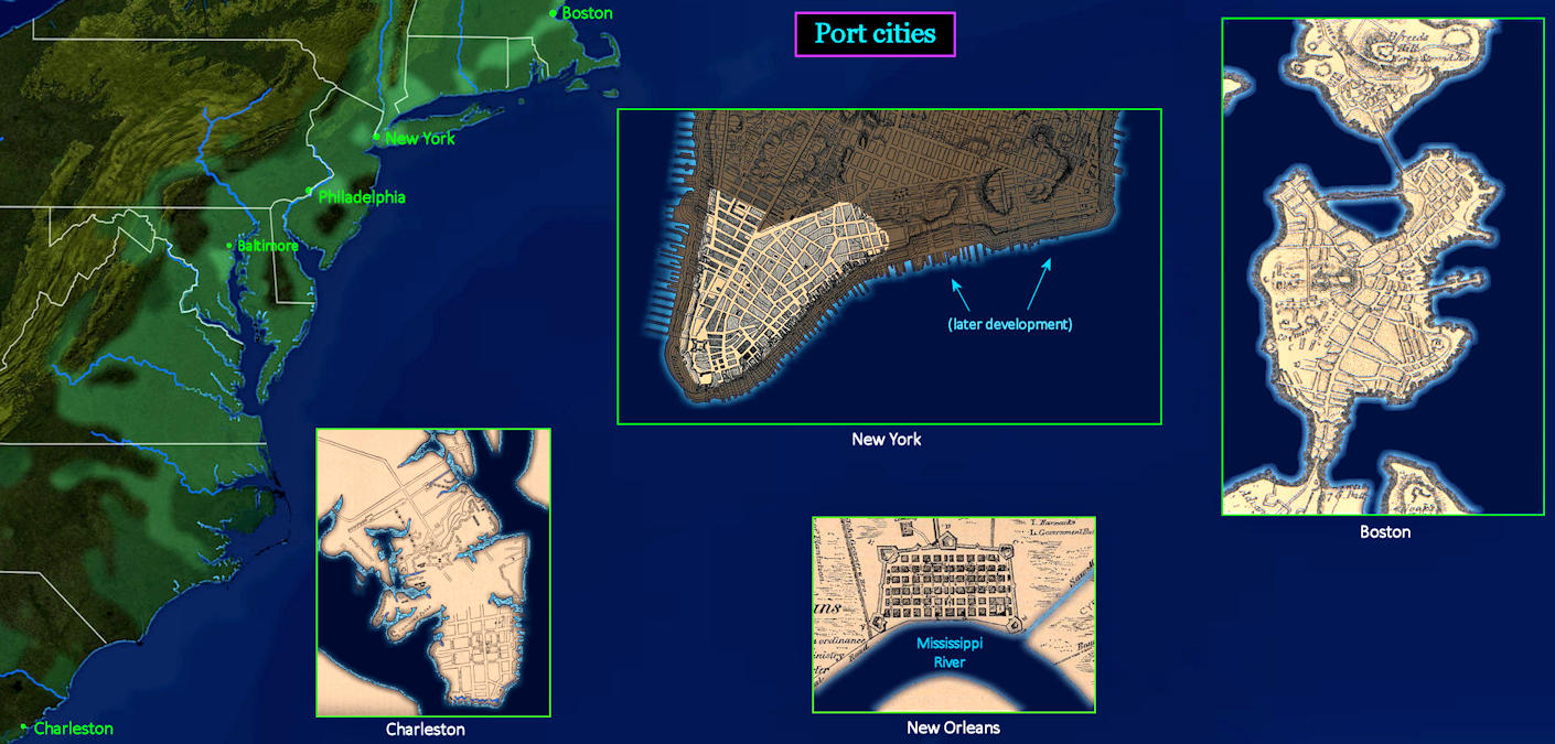
Real Cities By 1750, the major ports have become real cities. The big northern ports of Boston, New York and Philadelphia are now roughly the same size, with populations close to 20,000 each. In the South, Charleston and New Orleans have both grown to 10,000 residents. Charleston is swelling due to the rapidly growing slave trade. New Orleans is still a Spanish possession, but will be absorbed by America within 50 years. Chesapeake Bay finally has a thriving deep-water port at Baltimore, with 5,000 residents. | |||||||||
| |||||||||
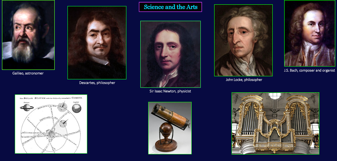
The Enlightenment Great thinkers in Europe are pushing science and the arts into new territory. Galileo develops an improved telescope to provide convincing evidence that the earth revolves around the sun. Descartes champions the 'scientific method,' where beliefs are based upon observable reality. Sir Isaac Newton virtually invents mathematics and physics through careful observation. John Locke argues that life is not preordained by God, but instead a blank slate. Bach creates music with mathematical precision. | |||||||||