| |
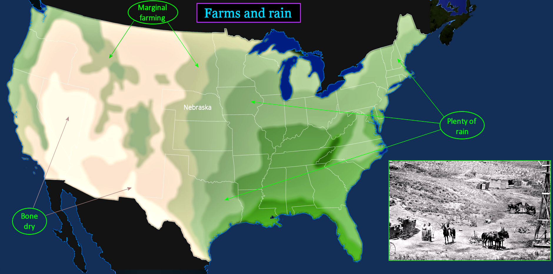
Stark Differences Light-colored areas on the map include western states that remain sparsely populated to this day. The dryness of the overall region is the reason that families living in the West are more likely to be ranchers than farmers. But that doesn't mean the land is worthless. Irrigation will soon enable more farming, while western mining is becoming increasingly important. |
| |||||||||
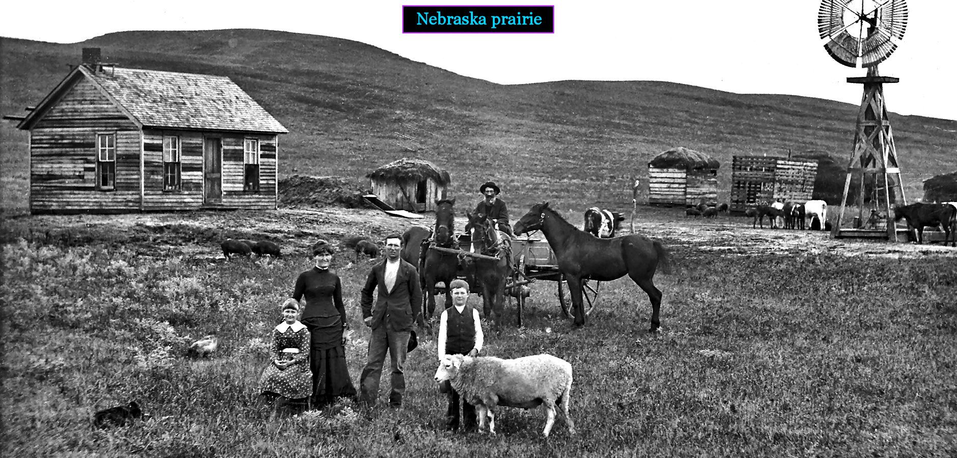
Dry Country America's great prairie, home of the buffalo, is not an easy place to live. A new kind of well is needed to raise drinking water from the ground. The wooden tower at far right uses pinwheel-type vanes to turn a vertical shaft, which pumps water from areas where groundwater naturally rises near the surface. This type of well is developed in the 1850s on the dry rangeland of West Texas, and quickly spreads north to Nebraska, where relentless prairie winds keep pumps working day and night. | |||||||||
| |||||||||
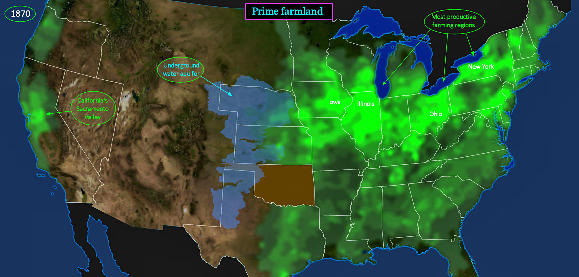
Crops Love Water The areas of brightest GREEN indicate America's heartland farming regions in 1880. All these areas have fertile soil and good rain. Western states, by contrast, are barely farmed at all. The Sacramento Valley in California is a prominent exception. Without irrigation, western Nebraska could not be farmed. Luckily, it sits atop the all-important Ogallala aquifer, which holds groundwater that can be pumped to the surface, making livestock farming possible. Even so, many wells must still be dug by hand. | |||||||||