| |
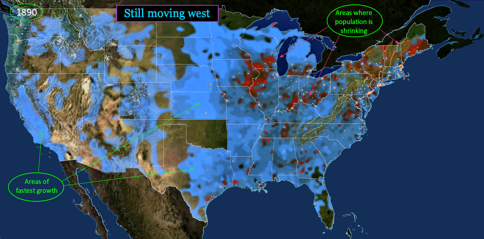
Blue and Red Regions with the brightest BLUE highlights (above) indicate those with the fastest growth rates, including everything in the western half of the country. RED highlights indicate counties with shrinking population. Note, however, that this indicates changes at the county level. The states themselves are all still growing somewhat, even as some individual counties are shrinking. |
| |||||||||
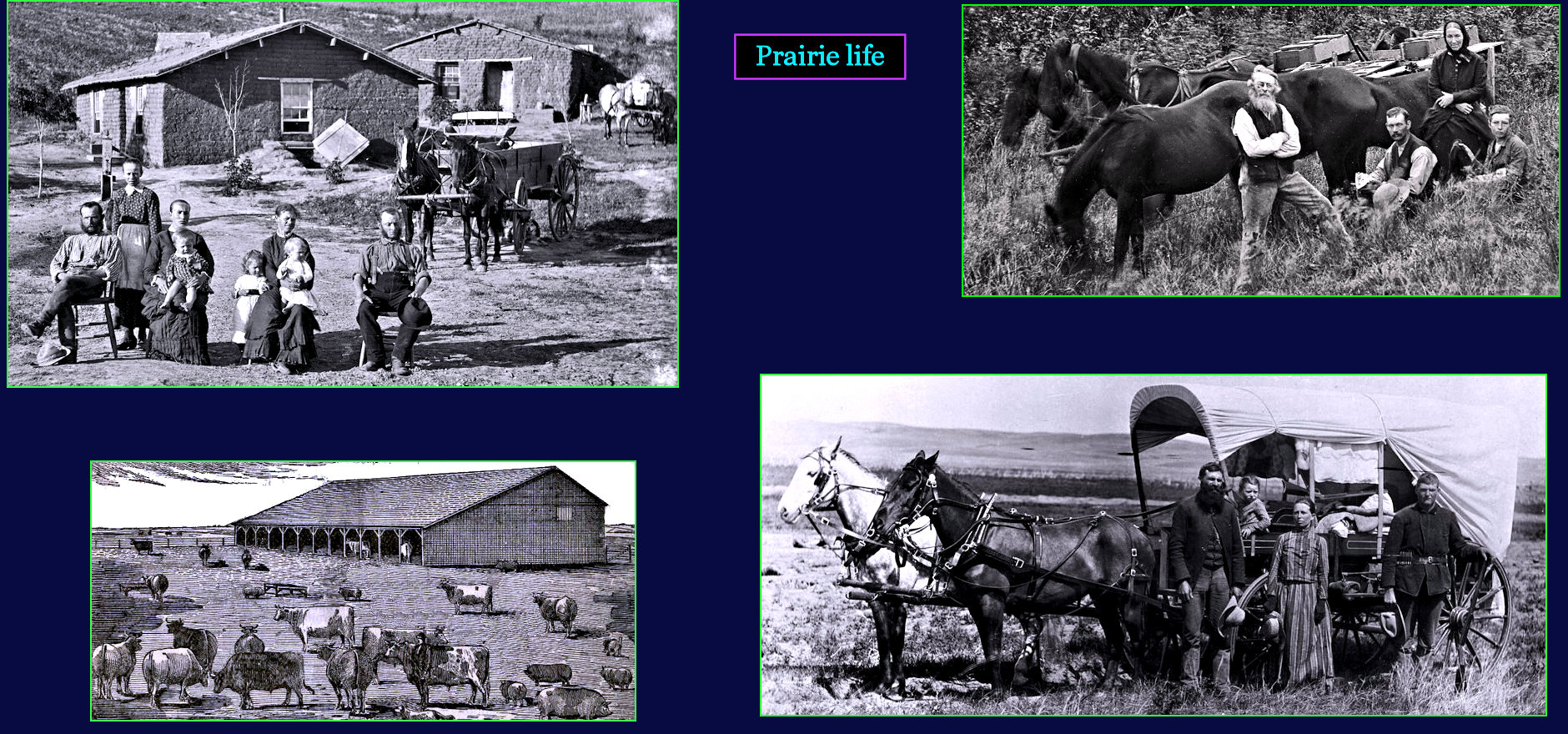
All Alone Trying to make a life for your family out on the prairie takes a lot of ingenuity, and even more grit. With so few trees, farmers cut the earth into brick-sized blocks to build sod homes (top left). With a good well, livestock can prosper, but some wives go mad with the solitude, and the relentless wind. Then there are the great rolling thunderstorms, and occasional tornados. But perhaps hardest of all is the lack of neighbors. Ranches are scattered, and children have few friends to play with. Schools barely exist. | |||||||||
| |||||||||
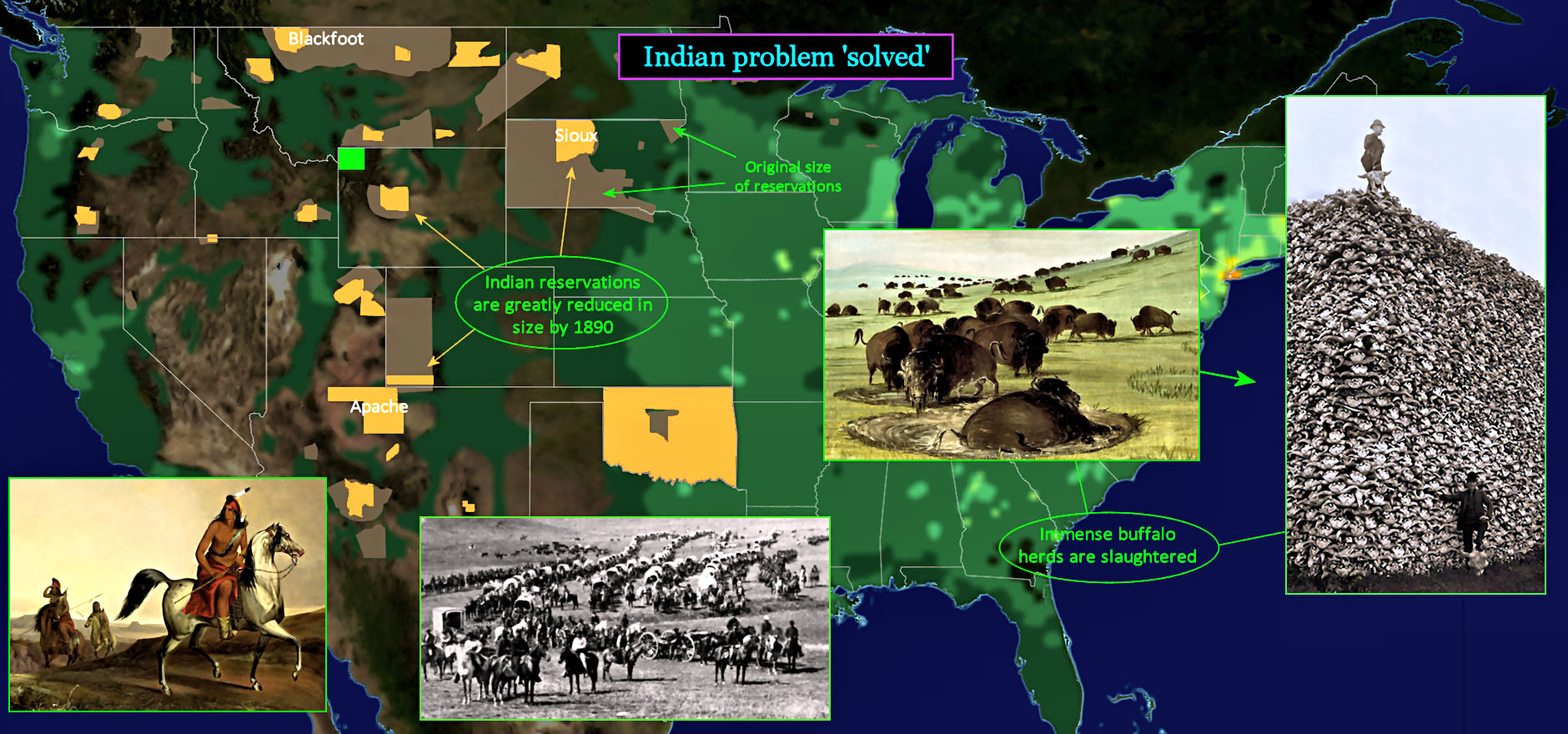
Put Them in a Box ... Somewhere It begins with Sioux Indians attacks, which kill hundreds of settlers, and force another 40,000 to flee. General Custer and the cavalry are dispatched to protect settlers, but his entire troop is wiped out when he stumbles upon a group of several thousand Indians, in a battle dubbed 'Custer's Last Stand.' After this, the cavalry rounds up all Indians it can find, and deposits them in reservations (YELLOW areas, reduced from previous BROWN areas). Some 30 million buffalo are slaughtered, to weaken Indian resistance. | |||||||||