| |
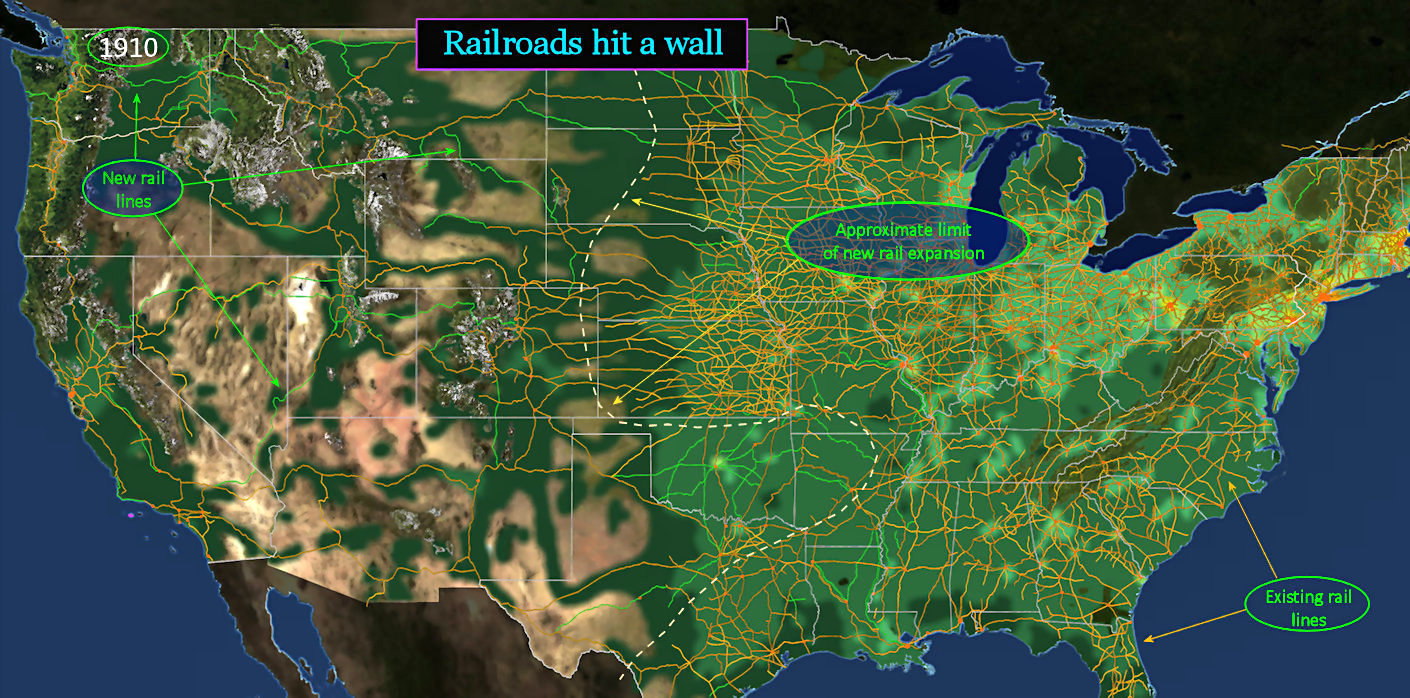
Game Over Given how rapidly railroads have been expanding over the previous 50 years, it's astonishing how quickly the enthusiasm fades. There are new lines crisscrossing Oklahoma, but only because it's the last tract of farmland left to be developed at the edge of the prairie. A few new rail lines are also added in the South and West (in GREEN), but almost none anywhere else. In the West, the new rail lines are mostly additional direct links to the Pacific Coast. A few service mining regions. |
| |||||||||
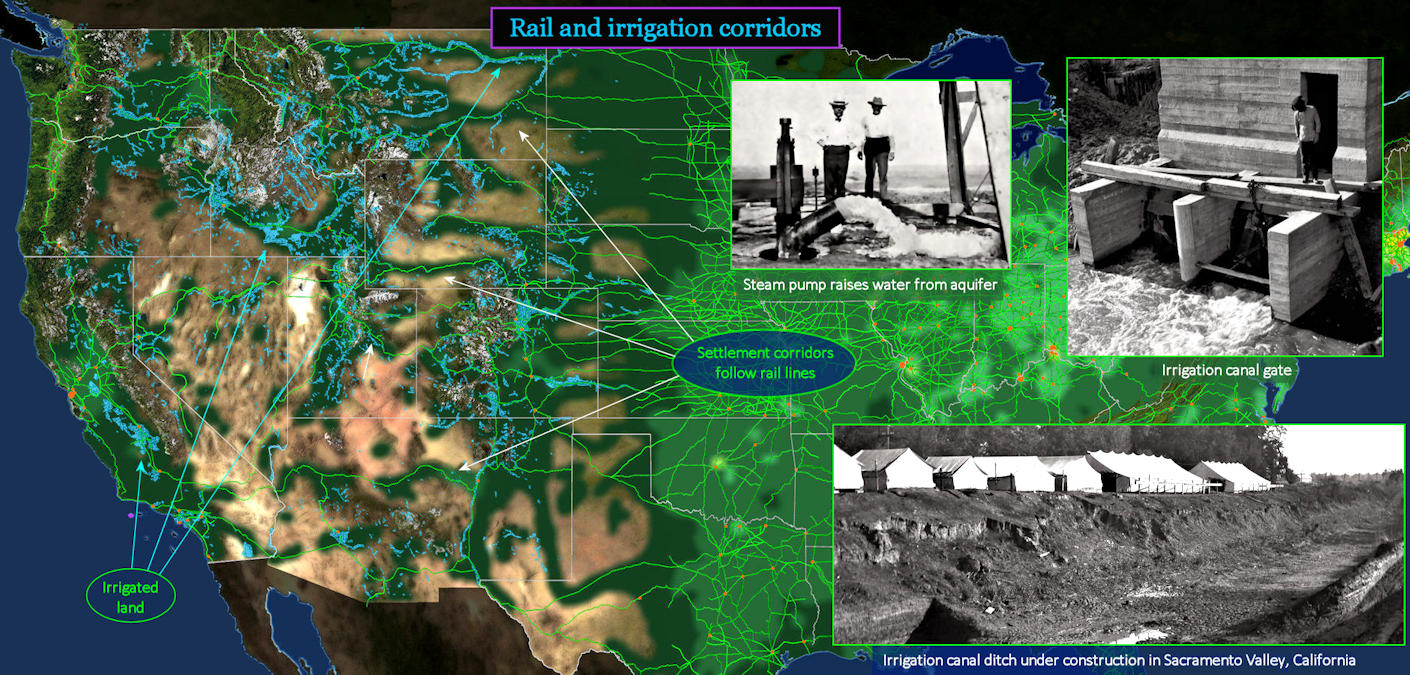
Settlement Corridors This map demonstrates how closely settlements are dependent upon rail lines in the West. Areas without GREEN highlights contain less than one person per square mile. In the East, settlements usually radiate in all directions, quickly filling in land up to the latest railroad frontier. In the West, settlements cling close to the rail lines themselves. Small settlements cluster around most of these stops, but don't expand outward. This results in a very unusual pattern, with great expanses of unsettled land between the rail lines. This patchwork pattern is still evident today. Irrigated acreage has tripled in the past 20 years, but also stays fairly close to rail lines (BLUE highlights). The photos (top and bottom right) show California's first major irrigation canal. | |||||||||
| |||||||||
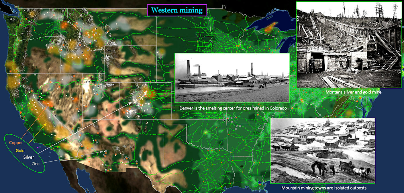
Silver in the Hills The prairie ends abruptly at Denver, which sits at the base of the great Rocky Mountains extending from Canada almost to Mexico. Few people attempt farming in the mountainous region beyond Denver, but there are great opportunities below the ground. Silver is king in Colorado, often mixed with some gold, and sprinkled widely elsewhere (WHITE dots). Copper is less common (ORANGE dots). But each of these mining locations is quite small. There might be a dozen mine shafts within a few miles of each other, but nothing in the surrounding areas. Mining is very much a hit-or-miss proposition, with small clumps of prospectors digging around everywhere, hoping to get lucky. | |||||||||
| |||||||||
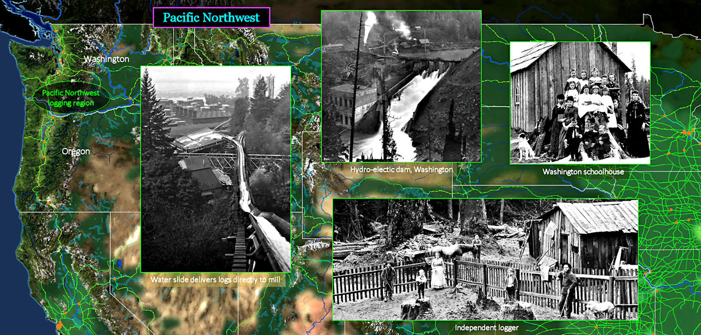
Western Logging The Pacific Northwest is unlike anything elsewhere in America, with the possible exception of the Maine coast. Rain, drizzle and fog tend to hug the coast, from Canada down into northern California. This is caused by cool ocean breezes, which are quickly forced upward by the coastal mountain range. With so much continuous moisture, trees grow to immense size. Consequently, the economy of the coastal Pacific Northwest is dominated by logging. Between this coastal area and the Mountain West, the climate is similar to the prairie. Farmers in eastern Washington grow wheat, while sheep farming is more common in eastern Oregon. | |||||||||
| |||||||||
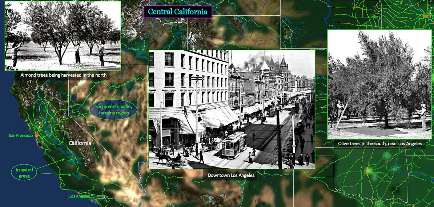
Vital Irrigation The California economy barely exists outside San Francisco and Los Angeles, although major irrigation canals are just beginning to appear in the central Sacramento Valley region. Wheat farmers and ranchers are still struggling with periodic droughts and floods, and many big landowners are in debt. Irrigation will soon allow more stable fruit and nut farms, which are much smaller and thus more manageable. Almond tree plantations are already appearing in the northern valley. Today, these have grown to an almost unimaginable size. Central California produces more food today than any other state, and far more than most entire countries. | |||||||||
| |||||||||
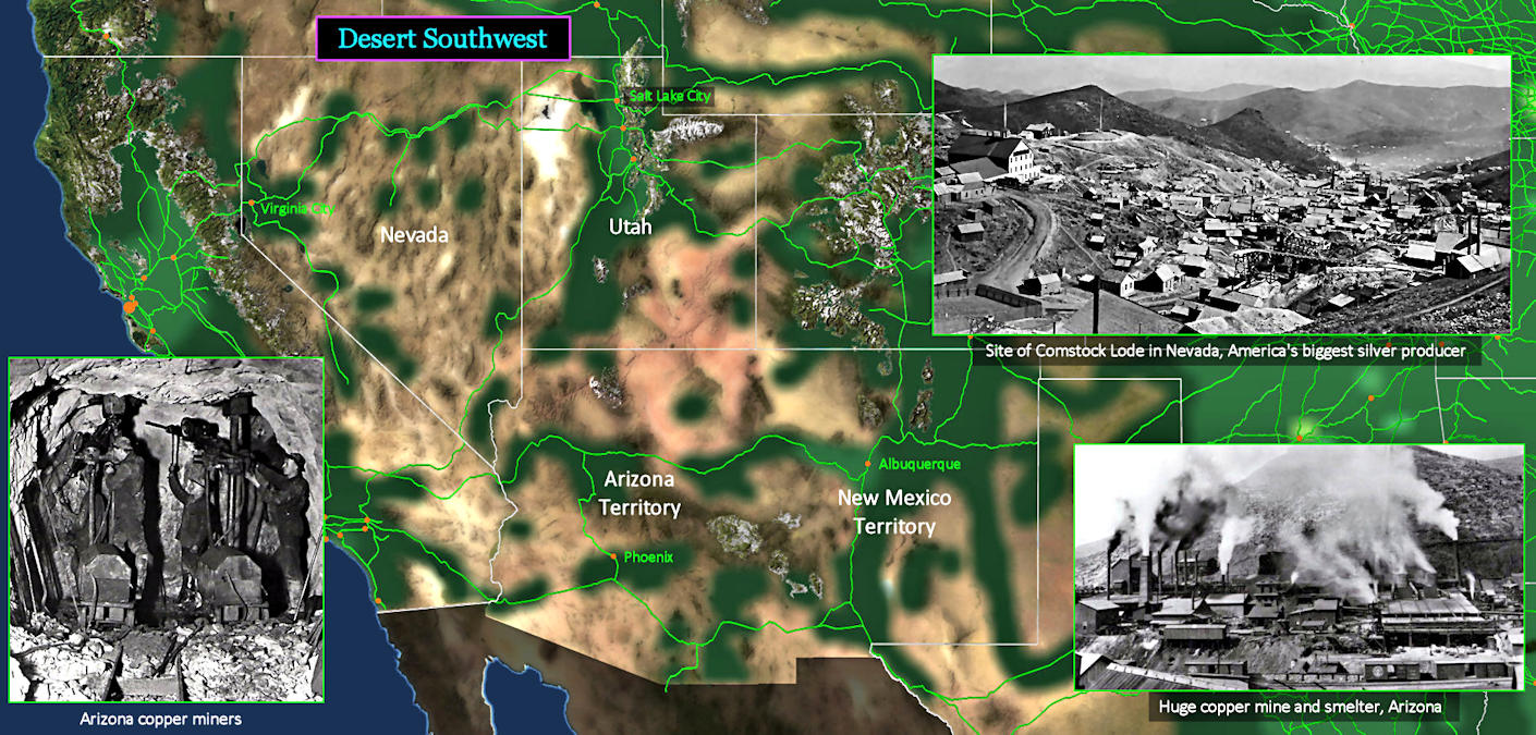
Copper and Silver The Desert Southwest contains most of the area between Central California and the Mountain West. It includes almost all the land in the states identified above. In 1910, the economy of this region barely exists, outside the widely scattered mines. Silver and gold are important in Nevada and Utah, while copper and zinc are more common to the south. Copper is in demand by the growing electrical industry, and is still used today for most electrical wiring. | |||||||||