Canals, Riverboats and RailTextile mills Canals National Road First railroads Steamboats 1850 End of the canal era Railroad explosion Cotton plantations |
| ||||||||||||||||
| |||||||||
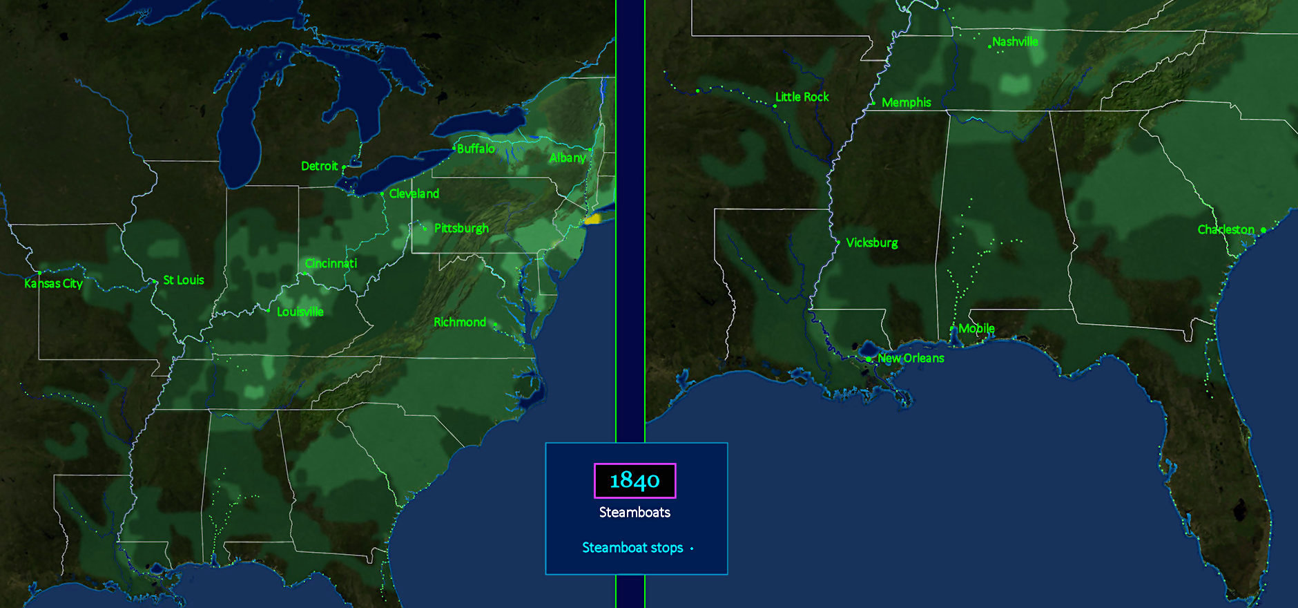
Faster than Barges Cargo on canals is carried on special barges designed to operate in narrow, shallow channels, pulled by horses or mules. Steamboats are used everywhere else, powered by early steam engines, which are so large they are only practical for large vessels. The BLUE dots indicate steamboat landings, where are located everywhere there is enough water to float a steamboat. Steamboats work every major river, and the entire southern coast, including all the way around Florida to Charleston. | |||||||||
| |||||||||
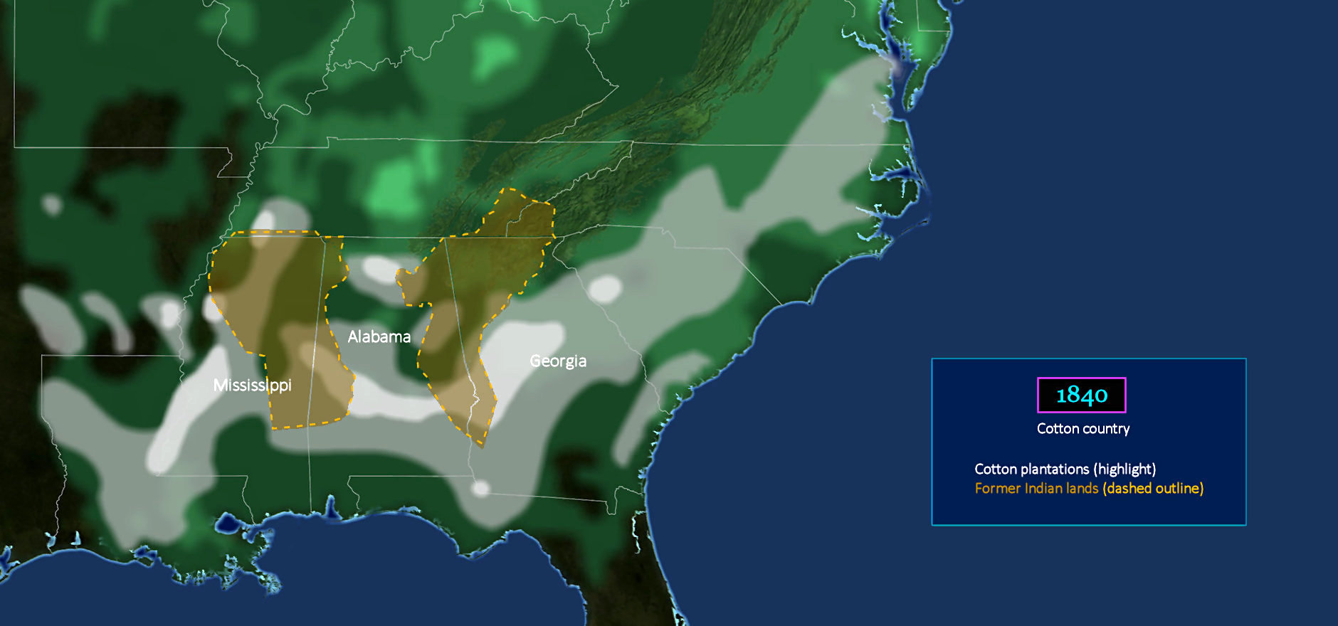
Cotton Replaces Indians The Deep South offers ideal conditions for the cultivation of cotton, which loves hot weather. This is made possible by the combination of two new technologies, the cotton gin and the powered weaving loom. But just as important is the ability of slaves to work all day outdoors under the grueling sun, in conditions which Whites find difficult to tolerate. Now we see why the Indians had to go. Southern planters need the land for cotton, which has already displaced tobacco as the big money-maker in the South. | |||||||||
| |||||||||
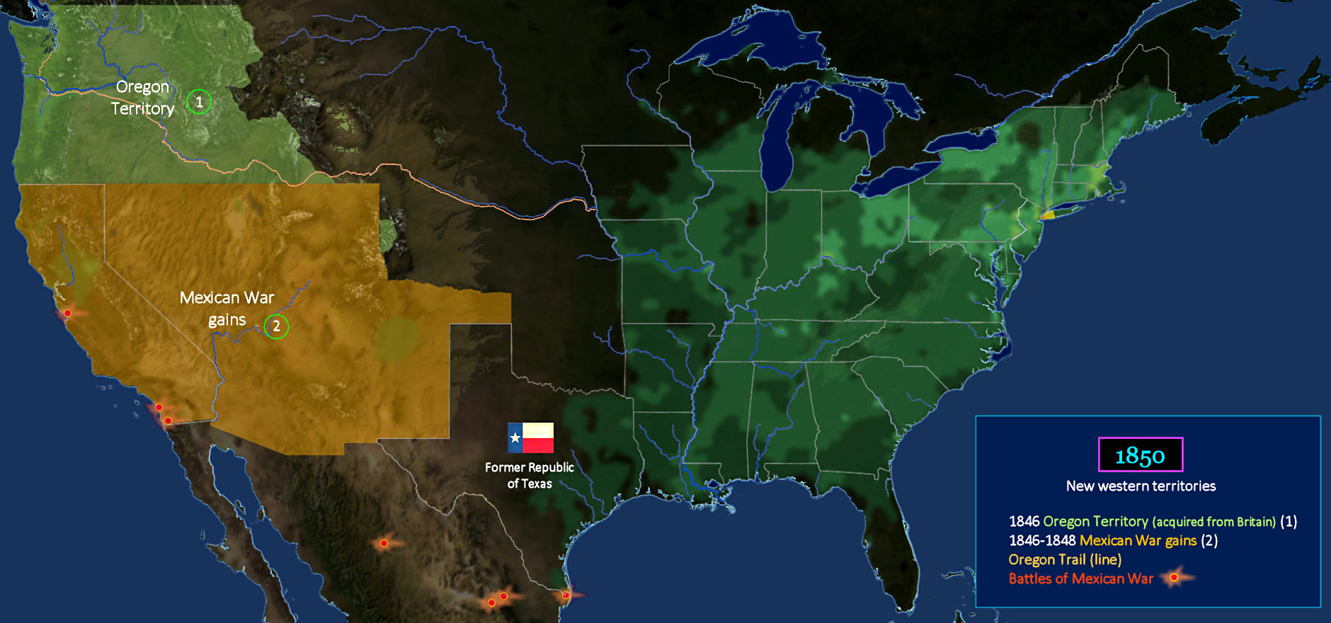
Mexican War Payoff The war with Mexico is triggered by events in Texas, where independent ranchers briefly establish the Republic of Texas in 1836. Mexico continues to claim ownership, but American settlers eventually coax Congress into annexing the territory, in 1845. Within a year, border clashes turn into a full-blown war, which lasts two years, and is fought entirely in Mexican territory. When it's over, America owns not only Texas, but also a huge new tract of western land, including all-important California. | |||||||||
| |||||||||
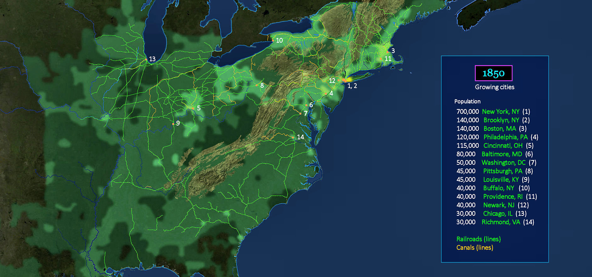
Railroads Sprout Cities The canal boom is just beginning to crest when it's blind-sided by an even more transformational technology. Railroads. In just 10 years, the rail system has exploded across the country, from east to west, and north to south. Every important supply center now has its own rail terminal, which turbo-charges growth everywhere, and greatly accelerates the movement of pioneers westward. Cargo can now be shipped almost anywhere, including the many areas not serviced by navigable rivers or canals. | |||||||||
| |||||||||
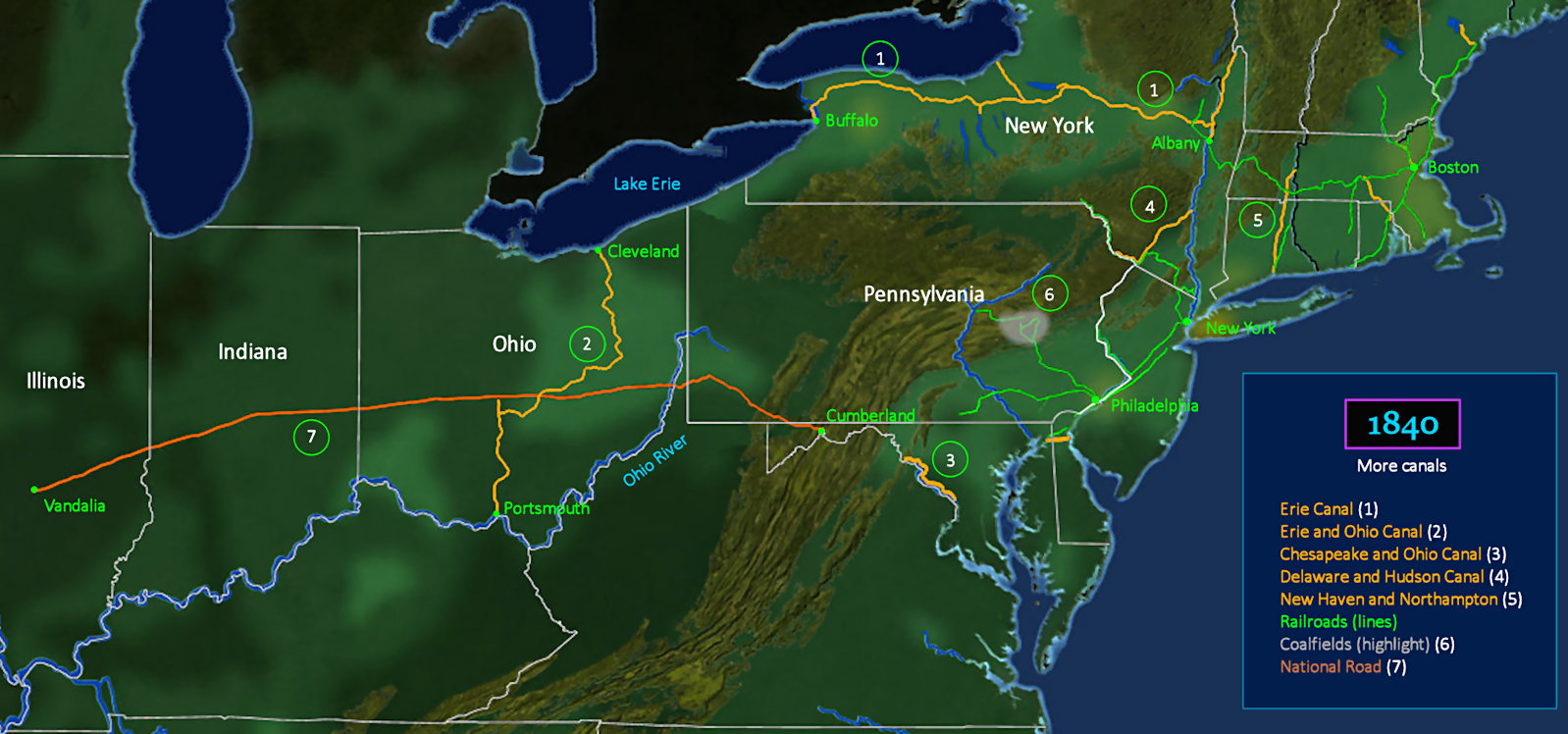
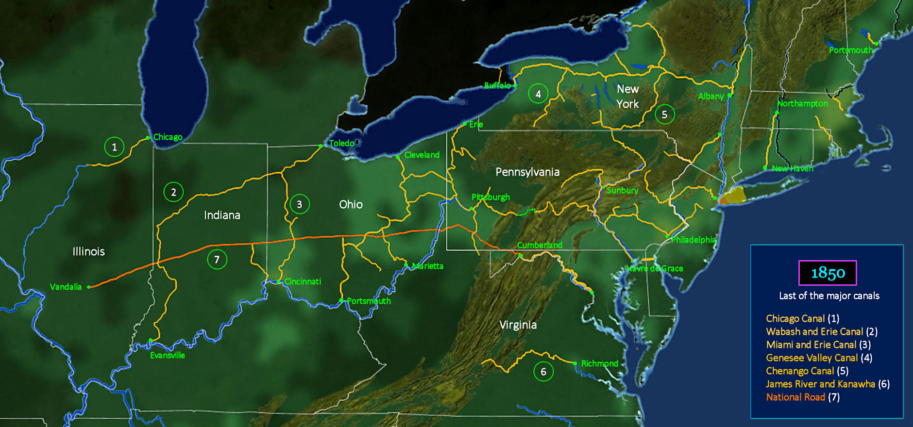
Boom Turns to Bust The canal-building era is now fully mature, as canals have spread all the way to Chicago. Pennsylvania's canal system is the most comprehensive, linking the state's eastern and western regions, and connecting with Chesapeake Bay. Other states establish new links between Lake Erie and the Ohio River. By now, however, canals are going head-to-head against railroads, in a competition they cannot win. Within 10 years, the faster and more versatile railroads will largely displace canals. | |||||||||